1. Background
Google Maps suggests a route based on distance and traffic conditions. However, it does not consider the following factors:
- Road conditions like flooding, potholes , broken roads, etc
- Type of traffic on each road (For example : Cyclists might want to avoid roads travelled by heavy vehicles)
- Crime (Avoid crime prone areas)
- Garbage dumps (Cyclists or people on foot might want to avoid filthy neighborhoods)
2. Contributions
Implement an intelligent routing system that suggests the best path based on the following factors:
1. Road conditions (potholes, open manholes, dirty roads, waterlogged roads,etc)
2. Crime Rate (Avoid paths that are known to have a high crime rate during the time of travel)
3. Green routing: Suggest a path that is pleasurable for the driver ; routes that have a good amount of green coverage
3. Data Sources
1. I change my city : Citizens post complaints pertaining to a wide variety of categories such as garbage, traffic, crimes, and potholes
2. Twitter : Crawled tweets mentioning potholes, Perform NER to recognize location, geocoded the location name to get the coordinates
3. Wikipedia : Extracted bus stop names, geocoded to get coordinates
4. Satellite Imagery : Segmented satellite images to get location of green areas.
4. Methodology
a. Data Extraction
Scraped and crawled data using requests and Elasticsearch.
Example: Extracted Bus Information in Bangalore from Wikipedia and geocoded to get coordinates.
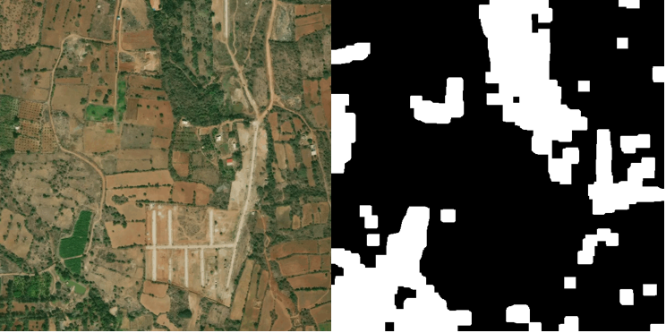
b. Satellite Image Segmentation
We used simple image processing techniques to extract a mask of the forest/ canopied areas from a series of satellite images.
Sample Results:
c. REST API
Built a REST API Service on IBM Bluemix. The inputs to the API are the geocoded latitudes and longitude of the location. The API returns a JSON object comprising of the best possible route coordinates.
4. Results
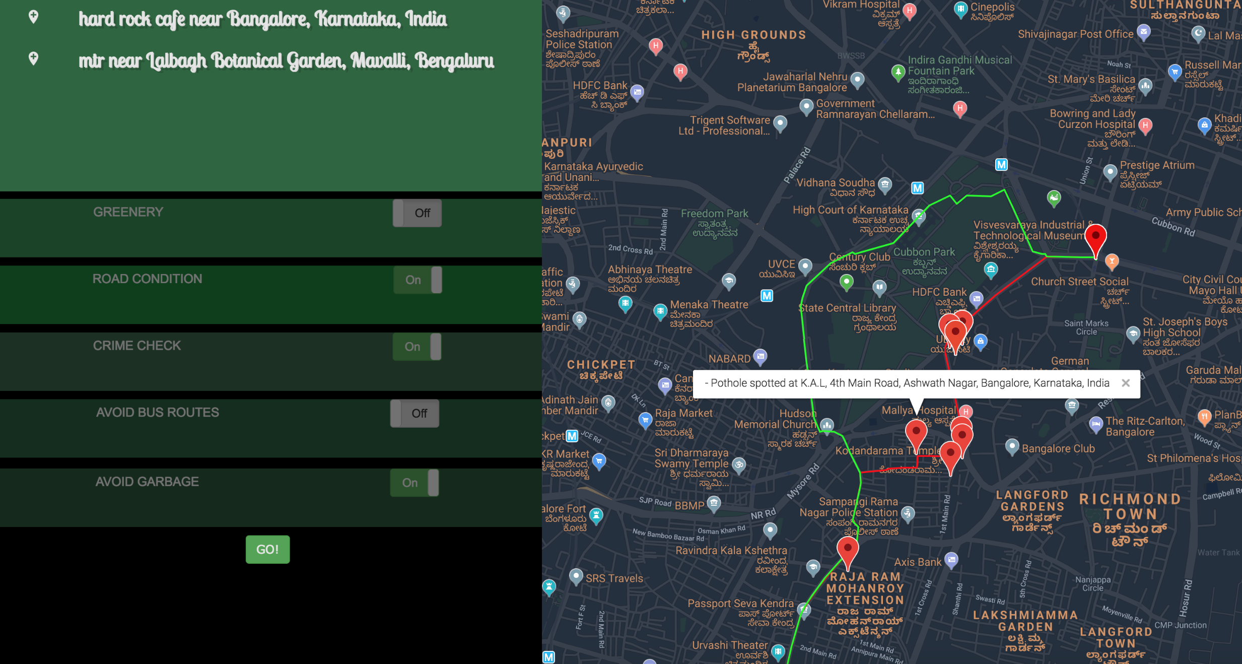
The route in green is returned by our algorithm. The route in red is based on Dijsktra's algorithm that does not take into consideration the conditions like road conditions , crime rate and so on. We can also see how our algorithm avoided the route with potholes.
Check it out: here